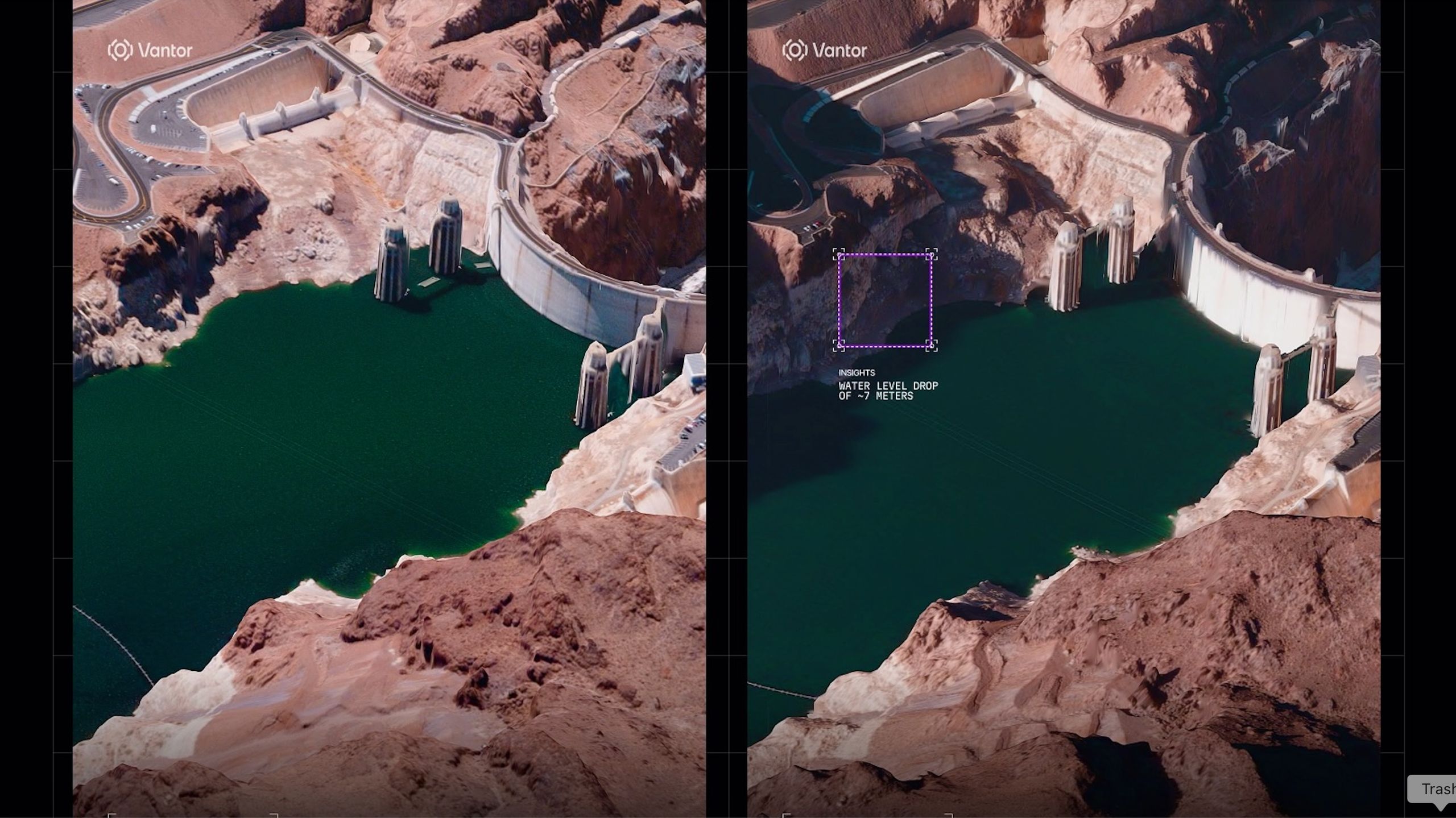
The American Earth-observation company Vantor maps Earth from space in 3D. The images are available in near-real time, revealing immediate effects of natural disasters and armed conflict. What is more, the images are also absolutely stunning.
Vantor, which operates a fleet of 10 satellites that image the surface of the planet with a resolution of 12 inches (30 centimetres), released the first set of its 3D shots from space on July 1. The images capture a variety of targets, all in amazing detail.
For example, there are shots of iconic landmarks in Paris; the Eiffel Tower, the Arc de Triomphe and the modernist quarter La Défense emerge in the images as if seen from a landing plane. Other image sets track the progress of ship-building activity at China’s Yulin Naval Base and decreasing water levels at Arizona’s Hoover Dam.


the standard resolution of 20 inches (50 cm) with an accuracy of 13 feet (4 meters) in all directions, and the HD version with a 6-inch (15 cm) resolution and a 10-foot (3 m) accuracy in all dimensions.
The 3D views are created by combining multiple satellite images taken from different angles and are updated every 24 hours or less to track even the most rapidly occurring changes in the landscape. The images form a basis for 3D maps that could, for example, help autonomous drones navigate in areas hit by GPS jamming.
The satellite fleet’s ability to rapidly update the imagery is a unique feature that was impossible to achieve by other 3D mapping technologies. Most commonly, mapmakers and organizations would have to conduct costly imaging campaigns from aboard aircraft or using remotely controlled drones. Neither of these approaches, however, allows such regular and frequent revisits, according to Vantor. On top of that, drones and planes may not be able to safely access and map areas controlled by unfriendly nations.

“From command and control to autonomous systems operating in GPS-denied environments, many of today’s most complex missions require current, accurate 3D terrain,” Peter Wilczynski, chief product officer at Vantor, said in a statement.
“With WorldView 3D, customers can update the specific areas they care about, including remote and contested areas where traditional aircraft collection is limited, with unmatched speed and scale,” Wilczynski added. “This is the future of spatial intelligence.”