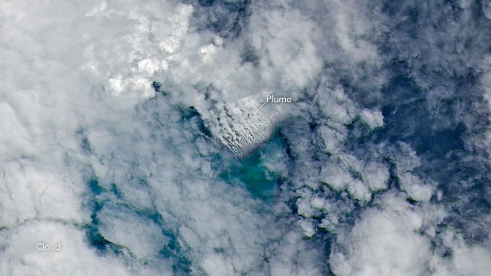
In early May, NASA satellites imaged an underwater volcanic eruption in the Bismarck Sea off the coast of Papua New Guinea. But when volcanologists looked to study the event, they reached a frustrating wall. There are no high-resolution maps of the seafloor here.
That lack of baseline data made it more difficult for scientists to determine exactly how the eruption reshaped the seafloor or how large the volcanic structure may be. In fact, they aren’t even sure which geological feature even erupted. Current theories suggest the eruption likely occurred along the Titan Ridge, about 10 miles (16 kilometers) southeast of a 1972 submarine eruption site.
“The good news is that there are huge opportunities to explore and learn using both government and commercial satellite platforms already in orbit,” Jim Garvin, the chief scientist at NASA’s Goddard Space Flight Center, said in a statement.
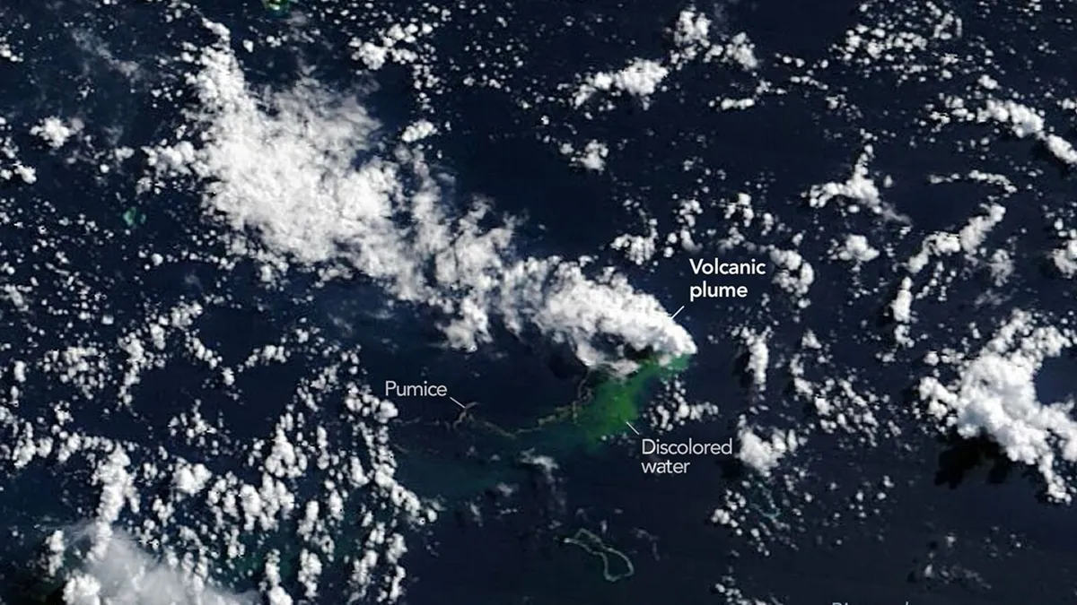
Existing satellite imagery allows scientists to analyze the miles-high ash plume, discoloration in the ocean water, rafts of the volcanic rock pumice emanating from the event, and even thermal events captured by the Visible Infrared Imaging Radiometer Suite (VIIRS) on NASA’s Suomi NPP satellite.
“There must be a lot of hot material near the surface to generate so many thermal anomalies,” Simon Carn, a volcanologist at Michigan Tech, said in the statement. “This suggests a fairly shallow eruption vent — much shallower than what’s implied by the existing bathymetry, which shows water depths of several hundred meters or more.”
Now, researchers are waiting to see if a new island will be born out of the eruption, which Garvin points out is something we’ve rarely observed via satellite in real-time. It would likely take some time for one to form, and it’s unclear how long this eruption might last. The nearby 1972 eruption, for instance, lasted four days, whereas another nearby eruption in 1957 lasted just short of four years.
If one does form, it might provide a chance for boots-on-the-ground research. “This new eruption could present an even better opportunity for ‘island-naut’ exploration as we prepare to return to the moon with women and men via Artemis IV,” said Garvin. With this, Garvin is referring to how researchers could study the budding island and test out how it responds to different weather events and introduction of some animal species — and even the humans themselves. Could the results from such studies inform how future astronauts attempt to create settlements on the moon and Mars someday?
Maybe so. But either way, we can be certain the discussion prompted by this satellite footage proves one common truism in oceanography: We know far more about the surface of the moon than the deep-ocean floor.