

A new study suggests the search for usable water on Mars may soon rely on an unexpected tool: drones equipped with radar, flying just above the surface to peer underground in ways orbiters cannot.
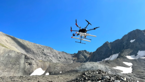
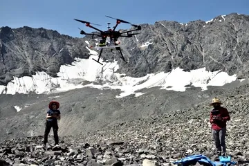
Researchers led by the University of Arizona have shown that drone-mounted ground-penetrating radar can map buried glaciers on Earth in remarkable detail, offering a blueprint for how similar techniques could be used on Mars. The work focuses on glaciers in Alaska and Wyoming that closely resemble debris-covered ice deposits identified on the Red Planet, according to a statement from the university.
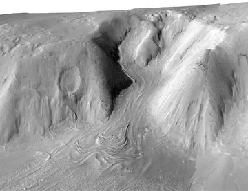
For decades, Mars missions have relied on orbital radar instruments, such as the Shallow Radar sounder (SHARAD) aboard NASA’s Mars Reconnaissance Orbiter, to detect subsurface ice. These systems have confirmed that vast amounts of water ice are locked beneath layers of rock and dust, particularly in the planet’s mid-latitudes. But while orbiters can identify large ice deposits, they struggle to resolve finer details near the surface — including exactly how deep the ice lies and how thick the overlying debris may be, Aguilar explained in the statement.
That limitation is critical. For future missions, knowing whether ice is buried beneath a meter of loose debris or tens of meters of hardened material could determine whether it is accessible at all.
The study shows drone-based radar can fill that gap. Flying low over glaciers across Alaska and Wyoming, researchers mapped ice thickness, detected debris layers just a few feet thick and revealed internal structures within the ice. The results were validated with field measurements from excavations and drilling, along with simulations confirming the radar signals originated beneath the debris.
On Mars, similar systems could scout buried ice and map the debris above it, resolving features orbiters cannot see. Instead of drilling blindly, mission planners could target locations where ice lies closest to the surface, providing a clearer picture of its depth and distribution.
“We already knew ground-penetrating radar works, but this was the first time we mounted it to drones and tested how we could put it into practice,” Aguilar said in the statement. “For instance, we learned at what altitude and speed the drone should fly, as well as the importance of flying in the direction of the glacier’s flow, and how to make sure the radar was properly aligned to detect the ice.”
Rather than replacing orbiters or rovers, drones could likely serve as intermediate scouts in a layered exploration strategy: orbiters identify broad regions, drones refine those maps at high resolution, and surface missions carry out drilling and analysis. This approach could reduce risk and improve efficiency by guiding missions to the most promising sites.
The implications extend beyond logistics. Water ice on Mars is both a scientific archive of past climate conditions and a potential resource for future astronauts, supporting drinking water, oxygen production and agriculture. Targeting the right locations could also improve the chances of detecting signs of past life.
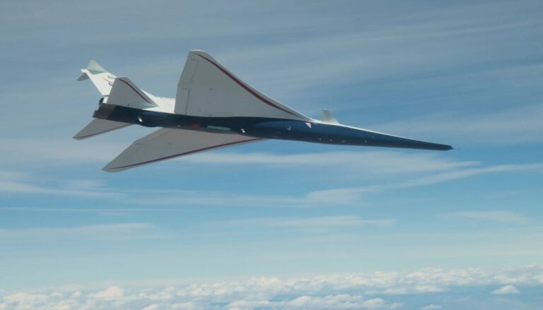
The idea builds on NASA’s Ingenuity helicopter, which demonstrated powered flight in Mars’ thin atmosphere and opened the door to more capable aerial science platforms.
“We are filling the gap between today’s orbital observations and a more distant future, where astronauts land on Mars and make observations on the ground,” Aguilar said in the statement. “This gives us a way to investigate the glaciers now, from the air.”
The study does not propose replacing existing mission architectures, but enhancing them with aerial systems that make exploration more precise and adaptable. By borrowing techniques from Earth-based glacier studies, scientists are turning the detection of buried ice into something far more practical for future Mars exploration.
Their findings were published March 24 in the Journal of Geophysical Research: Planets.