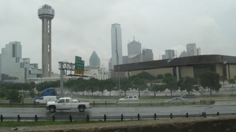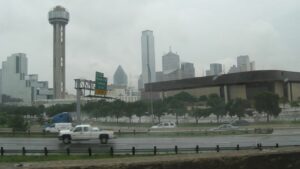


Travellers planning a trip through Queensland and New South Wales have been urged to stay vigilant as Cyclone Alfred looms across large stretches of Australia’s east coast.
The category two storm is expected to make landfall between Noosa and Brisbane on Thursday evening or early Friday morning.
The extreme weather event will bring with it winds of up to 130km/h, heavy rainfall and potential flooding, with residents already sandbagging their properties in preparation.
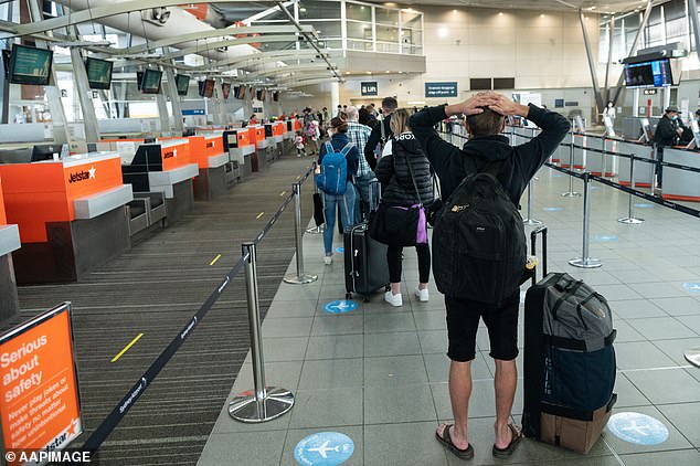
With the wild weather already wreaking havoc, Australian airlines have issued advice to those who were planning to travel later this week.
Virgin Australia said its meteorologists are closely monitoring Tropical Cyclone Alfred and its help centre has already been overrun with calls.
‘We understand people may no longer wish to fly to or from areas which may be impacted by Tropical Cyclone Alfred, so we are making it easier for guests to change their travel plans,’ a statement said.
Those travelling on services to or from Ballina, Brisbane, Bundaberg, the Gold Coast and Sunshine Coast airports between and including on March 4 and March 8 can choose to move their flight to a new date within 14 days from the original departure date.
Similarly, Qantas and Jetstar are also offering flexible flights to and from Bundaberg, Brisbane, Ballina, Hervey Bay, Coolangatta and Maroochydore.

Travellers planning a trip through Queensland and New South Wales have been urged to stay vigilant as Cyclone Alfred looms across large stretches of Australia’s east coast

Cyclone Alfred is on a direct collision course with Brisbane
Between March 4 and March 9, passengers can either retain the value of their ticket in credit or rebook another flight with the same origin and destination within 14 days.
Authorities in both Queensland and NSW also urge people planning to travel by car to check traffic updates.
For those who own boats, Transport and Main Roads Queensland released an ‘act now’ warning ahead of Cyclone Alfred.
‘Is your vessel on the water? ACT NOW,’ it said on X.
‘Owners that live-aboard or have a moored vessel are reminded to ensure they secure their vessel or relocate where possible.’
Meanwhile Brisbane City Council had to restock its sandbags and open additional collection sites for residents preparing for the storm.
The NSW State Emergency Service (SES) has been preparing communities in the Northern Rivers, Tweed Valley and Mid North Coast for the impact of Cyclone Alfred with additional personnel, specialised assets, and dedicated equipment set up.
Sealink also published a warning that, due to the storm, the Moggill Ferry that operates on the Brisbane River will not be running from Tuesday.

Travellers planning a trip through Queensland and New South Wales have been urged to stay vigilant as Cyclone Alfred looms across large stretches of Australia’s east coast

NSW State Emergency Service has been preparing communities across the region

Ingham in North Queensland was hit by flooding in February 5
‘At this stage, we do not have an estimated return date,’ a statement read.
‘We will provide further updates here when we have them.’
All CityCat and ferry services were also suspended on Monday until further notice, Brisbane City Council confirmed.
The worst of Alfred’s impact, once it makes landfall, will hit Queensland’s southern flank, including Brisbane, the Gold Coast and NSW’s Northern Rivers.
It is predicted to bring days of heavy rainfall and deadly flash floods, with 400mm of rain forecast for Brisbane while the Gold Coast is expected to be hit with 450mm in just three days.
The Queensland Premier addressed the public on Tuesday, and said while the presence of the cyclone was starting to be felt, it will be flooding later in the week that will cause the most havoc.
‘The flooding that comes after a system, particularly on the southern end, is very, very difficult and in many cases it can be the biggest complexity for us to handle,’ David Crisafulli said.
‘There are three stages of this significant weather event. The first is big surf and erosion. The second are those damaging winds and the third is significant rain and flooding.

Empty shelves at Woolworths on Bribie Island, Queensland (above and below)
‘We are well and truly in the first phase right now. Overnight we had a reading of a wave over seven metres at North Stradbroke so this is a significant system.’
Premier Crisafuli said schools in impacted areas will be closed on Wednesday, and that a decision was still yet to be made about Thursday.
Millions of residents are also being warned to prepare for days without power and minimal access to supplies.
As a result, supermarket shelves have been stripped bare in some stores as locals brace for impact, prompting a call for calm.
Bottled water, pasta, rice and canned foods have been stripped from supermarket shelves while there are reports that major Bunnings stores in Brisbane have sold out of torches, jerry cans, generators, power banks and 6V batteries and butane gas.