


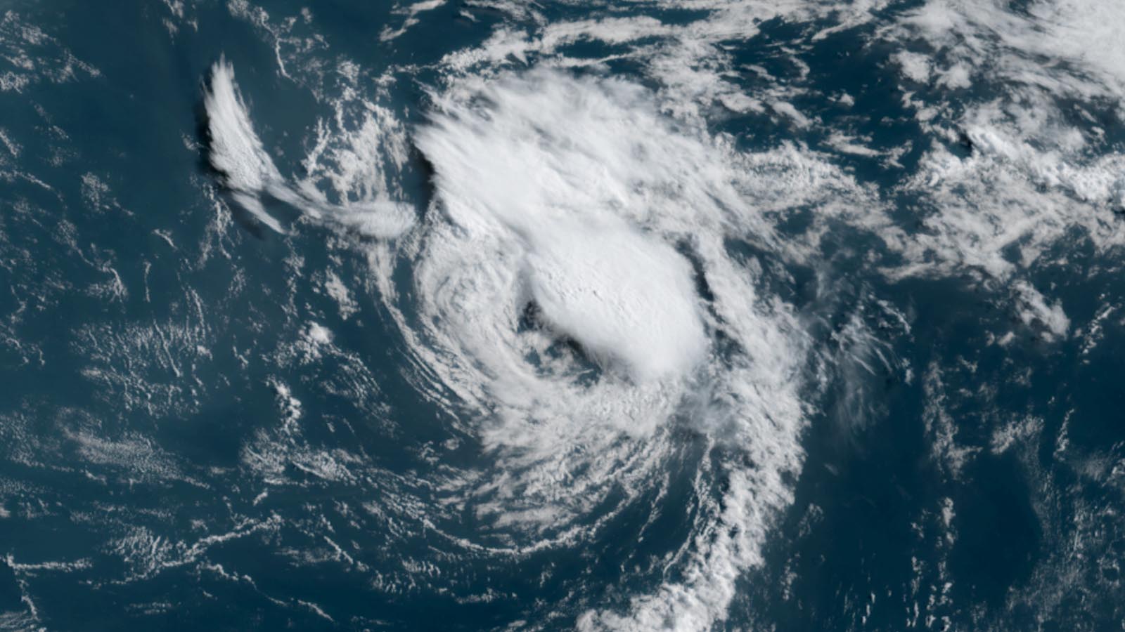
The 2025 Atlantic hurricane season is officially underway: Tropical Storm Andrea formed along a stalled cold front in the central Atlantic between Bermuda and the Azores Islands at 11 a.m. EDT Tuesday, June 24. At that point, Andrea had top sustained winds of 40 mph, a central pressure of 1014 mb, and was headed east-northeast at 17 mph.
As documented by Yale Climate Connections contributor Michael Lowry in his Substack feed, no June tropical depression, tropical storm, or hurricane has formed as far north and east as Andrea since recordkeeping began. Andrea’s unusual formation location was aided by sea surface temperatures (SSTs) that were the most anomalously warm of anywhere in the Atlantic – about 2 degrees Celsius (3.6°F) above average, though still well below the standard threshold for tropical storm development of 26 degrees Celsius (79°F).
Andrea’s formation date comes close to the typical June 20 appearance of the season’s first named storm based on 1991-2020 climatology, although the last few years have seen quite a few “A” storms in May and even April. In fact, Andrea is the latest “A” storm to arrive since 2014’s Hurricane Arthur was first designated a tropical storm on July 1. The usual date of the Atlantic’s first hurricane is August 11, but we’re not expecting Andrea to become a hurricane.
Satellite loops on Tuesday morning showed that Andrea had a small area of heavy thunderstorms that were decreasing in intensity and areal coverage. High wind shear of 25 knots, marginal sea surface temperatures of 24 degrees Celsius (75°F), and a dry atmosphere with a relative humidity at mid-levels of 45% were inhibiting development. These marginal conditions for development were offset by very cold temperatures aloft, which helped create the instability needed for Andrea to generate the heavy thunderstorm activity required to be designated a tropical storm.

Forecast for Andrea
Andrea has a short window of time to exist as a named storm, since steering currents are expected to take the storm east-northeastward into a region with cooler waters, high wind shear, and dry air. Andrea is likely to degenerate into a remnant low by Wednesday. According to info from our own Bob Henson and from hurricane scientist Phil Klotzbach, the shortest-lived “A” tropical cyclone in the Atlantic since Tropical Storm Amelia in 1978 was the previous incarnation of Andrea in 2019, which lasted just 0.75 days in the remote central Atlantic. The 2025 version of Andrea may be even shorter-lived than the 2019 version, although NHC could decide in post-storm analysis that Andrea actually formed 12 hours or more before it was named.
Andrea is the type of weak and short-lived storm that might not have been named in the days before satellite imagery was available in the Atlantic, as explained in our 2021 post, “Why are there so many Atlantic named storms? Five possible explanations.” The large increase in recent decades in the number of so-called “shorties” – named storms that last two or less days at tropical storm strength – has thus far not been demonstrated to have a climate change connection; improvements in our ability to detect and diagnose these systems are likely to be a major factor. Weak, short-lived early-season storms like Andrea have grown more common, making it difficult for storms beginning in A, B, and C to get their names retired: only three have been retired in the past 25 years (Allison, 2001; Charley, 2004; Beryl, 2024).

Bob Henson contributed to this post.