

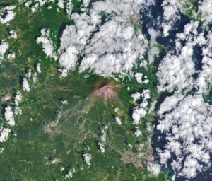

Jan Bartek – AncientPages.com – Michigan’s Upper Peninsula, known for its cold climate, short growing season, and dense forests, presents considerable challenges to farming. However, recent LIDAR (Light Detection and Ranging) research has revealed evidence of intensive agriculture by ancestral Native Americans at the Sixty Islands archaeological site, located along the Menominee River. This discovery identifies it as the most extensive ancient agricultural site in the eastern United States.

Credit: Madeleine McLeester, Dartmouth University. Two Menominee youths by George Catlin, 1835. Public Domain. Image compilation AncientPages.com
The site features a raised ridge field system dating from approximately the 10th century to 1600, much of which remains well-preserved to this day. These raised fields consist of clustered, ridged garden beds measuring between 4 and 12 inches in height. The ancestors of the Menominee Indian Tribe of Wisconsin used these beds to grow corn, beans, squash, and other plants.
In recent years, LIDAR technology has greatly assisted archaeologists in uncovering numerous previously undetectable ancient sites.
Lidar employs laser pulses for remote sensing to map objects on Earth’s surface accurately.
“Lidar is a really powerful tool in any kind of forested or heavily vegetated region where the archaeology is hidden below trees—where no kind of optical imagery can see what’s underneath the tree canopy,” says senior author Jesse Casana, a professor of anthropology at the who uses remote sensing technologies regularly in his work.
“Forests are really confounding to archaeology in a lot of ways, so a lot of archaeologists rely on publicly available lidar that has often been obtained from a plane that flies really high. But the resolution of the data is usually too low to see many archaeological features. Drone lidar enables us to collect the same kind of data but at a much higher resolution,” says Professor Casana.
Sacred Anaem Omot – “Dog’s Belly”
Anaem Omot, meaning “Dog’s Belly” in Menominee, is a significant sacred cluster of ancestral Menominee archaeological sites. This area features important sites, including burial mounds and a village, which were excavated between the 1950s and the 1970s. The site was first mapped in the 1990s by Marla Buckmaster from Northern Michigan University and further excavated by Jan Brashler of Grand Valley State University. During these excavations, they discovered and radiocarbon-dated a corn cupule.
Due to its cultural importance, featuring burial mounds, dance rings, and agricultural ridges, Anaem Omot is recognized on the U.S. National Register of Historic Places. In response to requests from Menominee tribal authorities for further exploration using advanced technologies, Dartmouth archaeologists collaborated with David Grignon and the late David Overstreet to survey this historic area.
In May 2023, the team conducted an innovative drone-based survey over a 330-acre expanse, leveraging new technology after winter’s end but before spring foliage emerged, using lidar technology.
According to lead author Madeleine McLeester, an Assistant Professor of Anthropology at Dartmouth, the agricultural system developed by ancestral Menominee communities is significantly larger than previously thought. The scale of this system is now estimated to be ten times greater than previously assessed.
The results compel us to reconsider several preconceived notions we have about agriculture, not only in the region but globally, Professor McLeester emphasized.
The researchers conducted a survey covering approximately 330 acres. However, the entire site has not been fully mapped, as it extends beyond the surveyed area. They estimate that their survey encompassed about 40% of the total site.
“When you look at the scale of farming, this would require the kind of labor organization that is typically associated with a much larger, state-level hierarchical society,” says McLeester. “Yet, everything we know about this area suggests smaller egalitarian societies lived in this region but in fact, this may have been a rather large settlement.”
LIDAR Discovered An Ancient Agricultural System, Previously Unknown Burial Mounds And More
In this study, LIDAR technology revealed a series of parallel ridges at the site, forming quilt-like patterns across the landscape. These ridges were constructed in various directions, suggesting that their placement may have been influenced by individual farmers rather than environmental factors like sunlight.
Additionally, the findings uncovered a circular dance ring; a rectangular building foundation potentially identified as a Colonial trading post; two 19th-century logging camps; looted burial mounds; previously unknown burial mounds believed to have been destroyed in the 1970s; and a burial mound on private land currently owned by a mining company.

Lidar data also showed, from left to right, a dance ring; a historic building foundation; a 19th-century logging camp; looted burial mounds; remains of unknown burial mounds; and a burial mound. Lidar images by Carolin Ferwerda and Jesse Casana.
In August 2023, researchers excavated three raised agricultural ridges at different distances from the Menominee River. Radiocarbon dating of charcoal samples from these excavations indicated that the ridges had been reconstructed over a span of approximately 600 years, with initial construction occurring around the year 1000 during the Late Woodland period.
“All three ridges showed a similar picture in terms of their construction, history and reconstruction,” says Casana. “Most field systems have been either lost or destroyed due to intensive land use across most of North America, through farming, including pastures, and the cutting down of trees for urban development.”
“Through this research, we get this little window of preservation into pre-Colonial farming in the Upper Peninsula of Michigan,” says Casana.
Excavations have uncovered charcoal, ceramic fragments known as sherds, and various artifacts. These findings indicate that remnants from fires and household waste were likely utilized as compost in agricultural fields. Additionally, the results revealed that wetland soils had been employed to enhance soil fertility.
“Our work shows that the ancestral Menominee communities were modifying the soil to completely rework the topography in order to plant and harvest corn at the near northern extent of where this crop can grow,” says McLeester. “This farming system was a massive undertaking requiring a lot of organization, labor, and know-how to maximize agricultural productivity.”
“We’re seeing this kind of landscape alteration in a place where we wouldn’t expect it,” says McLeester.
“This may be just a little remnant of what must have been a much larger system,” says Casana.
See also: More Archaeology News
The research findings have prompted scientists to reconsider the possibility that much of eastern North America was once covered with agricultural ridges. These discoveries also question the current understanding of the forest history in the Upper Peninsula, suggesting that Sixty Islands might have been deforested during this 600-year period. The research team is continuing their collaboration with the Menominee Indian Tribe of Wisconsin at the Menominee Sixty Islands site. They are planning future surveys to explore and identify ancestral Menominee villages in this area.
The study was published in the journal Science
Written by – Jan Bartek – AncientPages.com Staff Writer