


Jan Bartek – AncientPages.com – The Lacandon people are historically recognized as a resilient group in Chiapas, having resisted Spanish colonization for the longest period. After their capital fell to Spanish forces, they retreated deeper into the rainforest to Sak-Bahlan. For over a century, they successfully defended against Spanish advances.

Credit: Josuhé Lozada (CINAH Chiapas)
The exact location of this city eluded archaeologists for many years until four explorers made a significant discovery deep within the rainforest. Jan de Vos’s book “The Peace of God and of the King” (1988) begins with an exploration of ethnocide, detailing how colonial forces ultimately destroyed the Lacandon-Ch’olti’es—the last Mayan rebels in Chiapas.
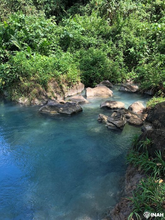
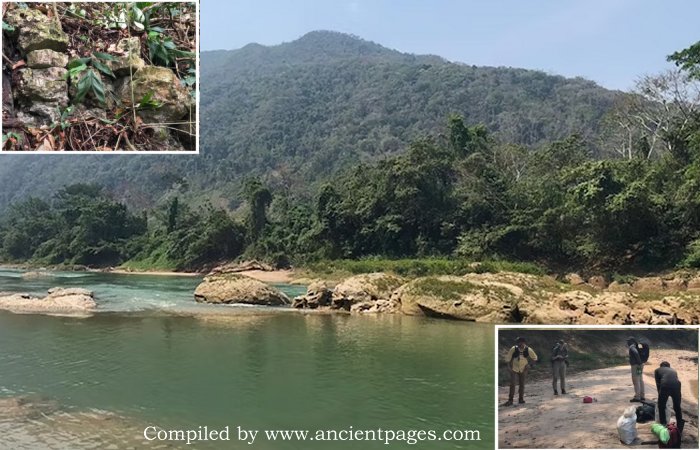
Surroundings of Lake Miramar. Credit: Josuhé Lozada, CINAH Chiapas
Their final refuge at Sak-Bahlán was discovered by Friar Pedro de la Concepción in 1695, was overtaken and renamed Our Lady of Sorrows, and was abandoned in 1721. Recently, scientists from the Sak-Bahlán Archaeological Project believe they have rediscovered this “land of the white jaguar,” three centuries later.
The project, co-directed by experts from Winthrop University (USA) and Rissho University (Japan), includes the participation of the INAH (National Institute of Agricultural Research). Credit: Josuhé Lozada, CINAH Chiapas
The National Institute of Anthropology and History (INAH) has announced a significant archaeological discovery: the remains of a fortress where the Maya people resisted Spanish colonization.
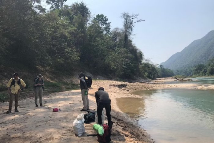
Earlier this year, four researchers embarked on an expedition through challenging terrain in Chiapas. Navigating dense vegetation and steep slopes, they braved encounters with insects, snakes, and jaguars to locate the lost Maya city of Sak-Bahlan, founded by the Lacandon people.

Tzendales River. Credit: Josuhé Lozada, CINAH Chiapas
Historical records suggest that during its peak in the 17th century, Sak-Bahlan was home to about 500 inhabitants. The Lacandon people preserved their culture and lifestyle by hiding in the rainforest and resisting Spanish conquest. They relied on agriculture, particularly maize cultivation, and engaged in clandestine trade with other Mayan groups to maintain their independence. Although a Spanish expedition discovered their fortress in 1695 and subsequently conquered it, by 1721, they had abandoned it.
The search for Sak-Bahlan was led by Brent Woodfill from Winthrop University in the USA and Yuko Shiratori from Rissho University in Japan, with significant contributions from archaeologist Josuhé Lozada of INAH. Lozada utilized Geographic Information System (GIS) technology to create a detailed map incorporating extensive datasets, including topography, vegetation, travel speed considerations, and historical accounts, such as those of monk Diego de Rivas, dating back to 1698.
Lozada explains that the Lacandon-Ch’olti’ maintained their independence for 110 years after their capital, Lacam-Tún (“Great Rock”), was captured by the Spanish in 1586. Documentation on the 1695 entry into Sak-Bahlán reveals that this Lacandon enclave was situated on a plain encircled by a bend of the Lacantún River.

The archaeological project has conducted two field seasons to map the site and construct test pits to determine its temporal occupation. Credit: Josuhé Lozada, CINAH Chiapas.
Using GIS technology, Lozada reconstructed pre-Hispanic and historical communication routes of Mayan groups. By employing ArcGIS Pro software, he layered information to perform calculations and predictive analysis. He drew on Friar De Rivas’s chronicles from 1698, which describe how he and soldiers traveled four days from Nuestra Señora de los Dolores (formerly Sak-Bahlán) to reach the Lacantún River. They then sailed two days to El Encuentro de Cristo, where they joined another river before proceeding on foot to Lake Petén Itzá in Guatemala.
By georeferencing the locations mentioned in historical texts and converting travel times into distances along known routes, while considering variables such as terrain altimetry, vegetation layers, proximity to water bodies, and cargo weight per person, Lozada proposed an approximate location for Sak-Bahlán on his map.
Upon reaching this mapped location within the rainforest, researchers combined these insights with detailed chronicles describing river navigation routes. They discovered compelling archaeological evidence confirming past habitation at the site, including remnants that indicate structures such as churches built under Spanish influence.
See also: More Archaeology News
Archaeologist Josuhé Lozada Toledo emphasized the significance behind the discovery, stating: “It is much more than an archaeological find—we give voice back to obliterated history regarding the Maya peoples’ plight who chose seclusion over subjugation.”
Source: INAH
Written by Jan Bartek – AncientPages.com Staff Writer