
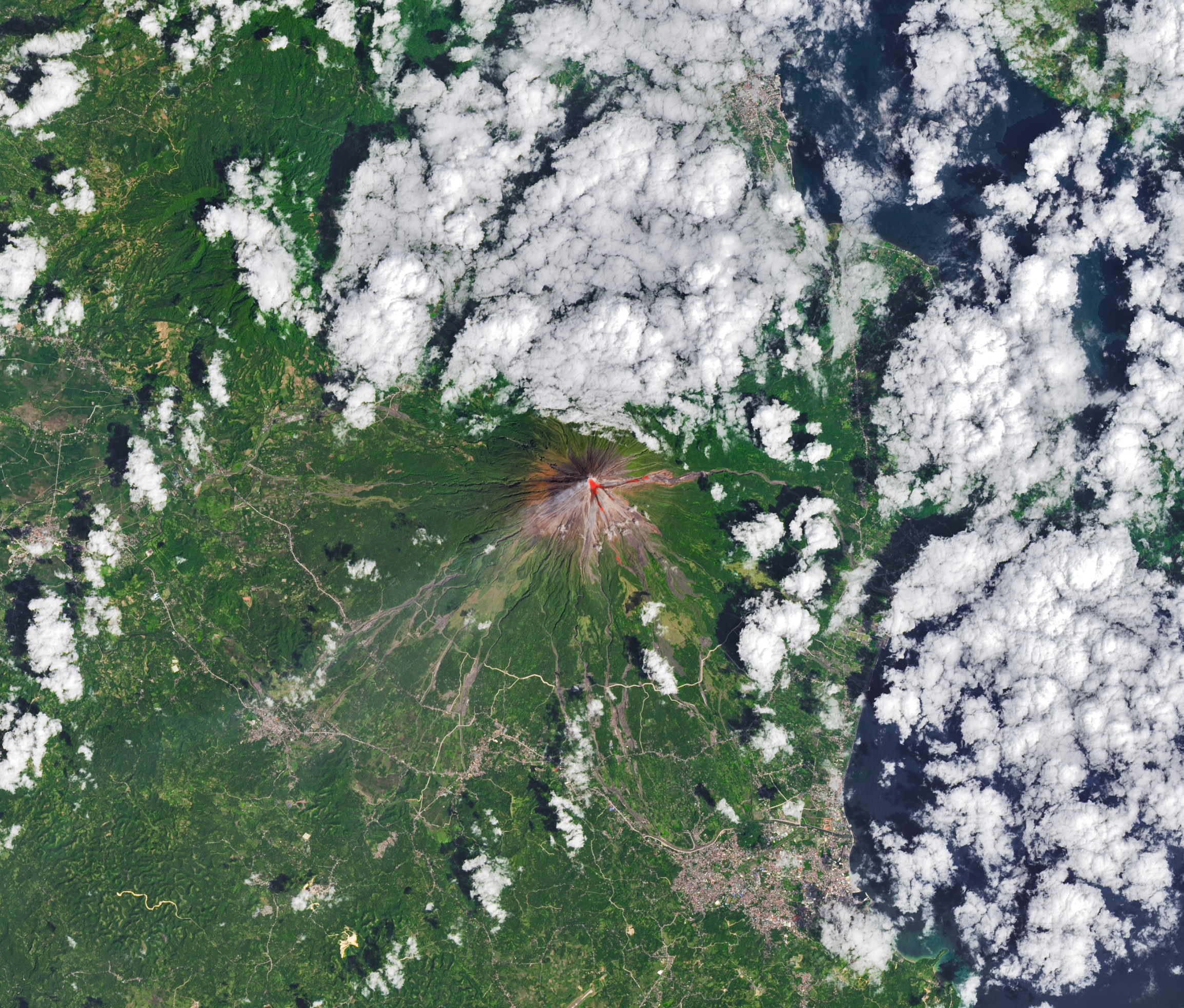
The OLI (Operational Land Imager) on Landsat 8 acquired this rare, relatively clear image of Mayon, the most active volcano in the Philippines, on Feb. 26, 2026. The natural-color scene is overlaid with infrared observations to highlight the lava’s heat signature. On that day, the Philippine Institute of Volcanology and Seismology (PHIVOLCS) reported volcanic earthquakes, rockfalls, and hot clouds of ash and debris called pyroclastic flows. Along with PHIVOLCS, multiple NASA satellites also monitored the volcano’s sulfur dioxide emissions, showing sizable plumes of the gas drifting southwest on February 4 and March 6.
Read more about Mayon.
Text credit: Adam Voiland
Image credit: Michala Garrison, using Landsat data from the U.S. Geological Survey