


A sweeping new satellite analysis shows that Antarctica has lost nearly 5,000 square miles (12,950 square kilometers) of grounded ice over the past three decades — an area roughly twice as big as Delaware — as warming ocean waters erode the continent’s most vulnerable edges.
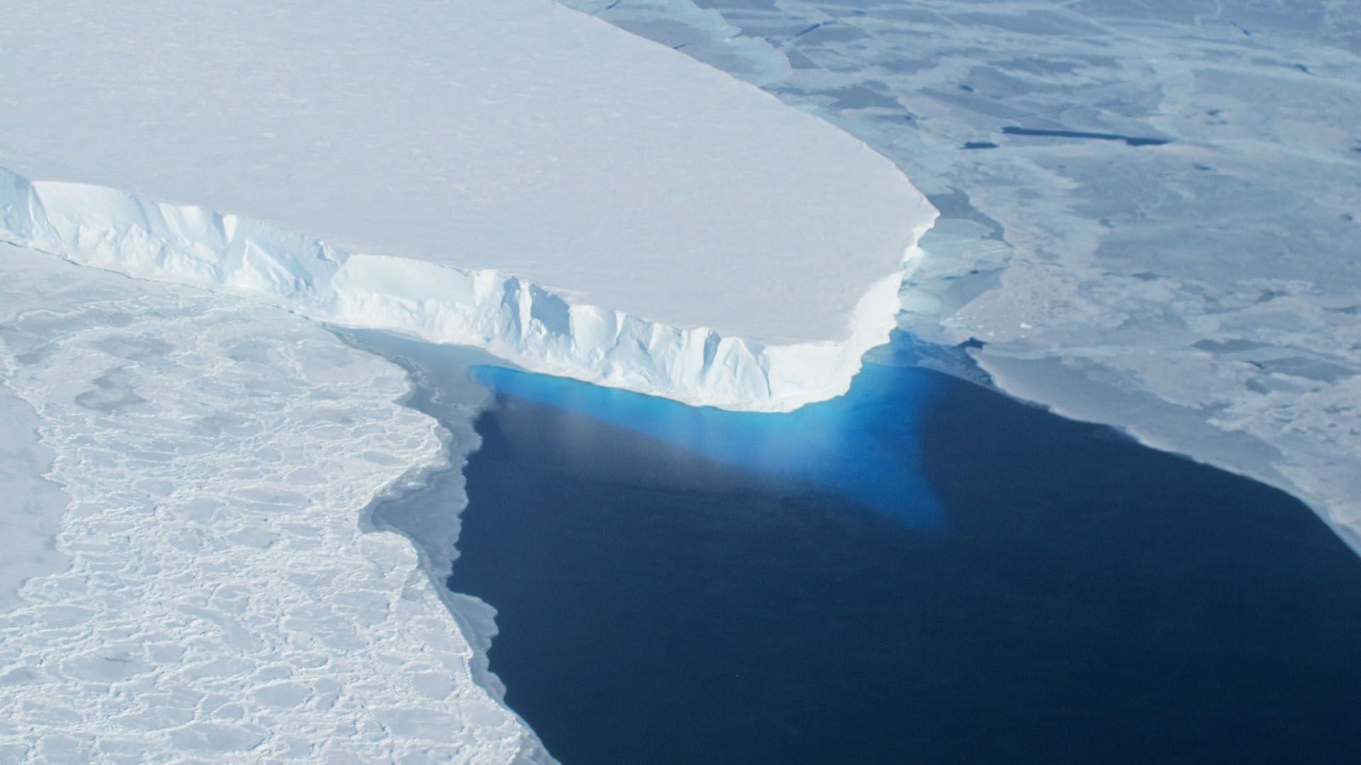
Led by scientists at the University of California, Irvine, the study traces how Antarctica’s “grounding line” — the boundary where ice anchored to bedrock begins to float on the ocean — shifted between 1992 and 2025. Because that boundary marks where land-based ice begins contributing directly to sea level rise, its retreat signals ice-sheet instability and future ice mass loss.

Rignot and his colleagues analyzed data from a wide range of satellite missions operated by European, Canadian, Japanese, Italian, German and Argentine space agencies. Using radar instruments, the researchers tracked the vertical movements of floating ice shelves caused by ocean tides. Grounded ice remained fixed on bedrock, allowing them to pinpoint shifts in the grounding line over three decades with unprecedented precision.
The results show that about 77% of Antarctica’s coastline experienced no detectable grounding-line migration since 1996, suggesting broad stability across much of the continent. But in vulnerable regions, particularly parts of West Antarctica, the Antarctic Peninsula and sections of East Antarctica, the study found “significant retreat.”
The largest changes were detected along the Amundsen Sea coast of West Antarctica and in the Getz sector, where the grounding line in some places pulled back by as much as 26 miles (42 km) during the study period.
Retreat was most pronounced where deep underwater pathways funnel warm ocean water toward the base of glaciers, Rignot said. That warmer water melts ice from below, thinning floating shelves and weakening their ability to buttress the glaciers behind them.
“It’s like the balloon that’s not punctured everywhere, but where it is punctured, it’s punctured deep,” said Rignot.
The study also highlights a puzzling pattern along the northeast Antarctic Peninsula. In that area, several ice shelves collapsed before the study period and multiple glaciers have since retreated significantly, but researchers lack clear evidence that warm ocean water is driving the change.
“Something else is acting — it’s still a question mark,” Rignot said in the statement.
Beyond documenting what has already happened, the researchers say the new record provides a crucial real-world test for computer models used to project future sea level rise.
“Models have to demonstrate they can match this 30-year record to claim credibility for their projections,” Rignot said in the statement. “That’s the real value of this observational record: knowing that this grounding line migration has happened.”
While much of Antarctica remains stable, Rignot cautioned that the current balance may not hold indefinitely.
“The flip side is that we should perhaps feel fortunate that all of Antarctica isn’t reacting right now, because we would be in far more trouble,” he said. “But that could be the next step.”
This research is described in a paper published March 2 in the journal Proceedings of the National Academy of Sciences.