


The massive glaciers of Greenland are disappearing right before our very eyes in new satellite imagery.
What is it?
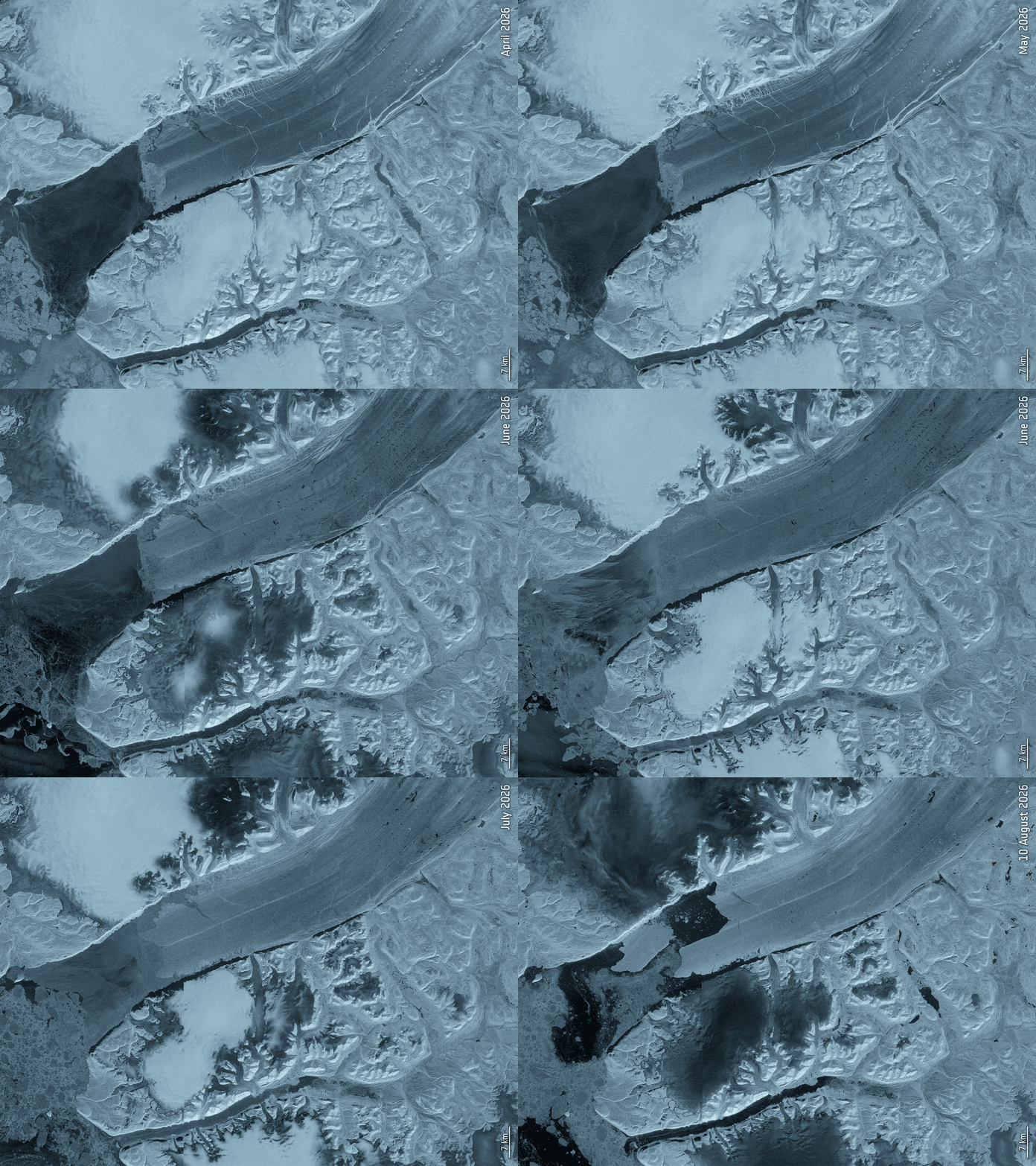
Petermann Glacier in northwest Greenland connects the Greenland ice sheet to the Arctic ocean. Petermann’s “ice tongue” has previously measured 43 miles (70 kilometers) long and 9 miles (15 km) wide. But new satellite imagery has revealed the glacier’s floating “ice tongue” has broken apart in the glacier’s most dramatic loss of floating ice since 2012.
On August 4, 2026, the European Space Agency’s Copernicus Sentinel-1 mission captured imagery of the glacier that revealed that a 29 square mile (76 square km) section of the ice tongue has broken away. This is the most significant ice calving event (where ice breaks off of a glacier) seen in the Arctic since 2020.
“Satellite missions such as Sentinel-1 provide the systematic, long-term observations needed to track these changes, helping scientists better understand the processes driving calving and the wider impacts on the polar environment, and ultimately the Earth system as a whole,” ESA Earth scientist Martin Wearing said in a statement.
Why is it incredible?
It is no secret that worsening climate change is contributing to significant ice loss. Antarctica has lost 5,000 square miles (12,950 square km) of grounded ice over the last three decades. Warming oceans are consistently eroding the arctic ice we have left which, when melted, contributes to rising sea levels.
But knowledge is power, and by studying Earth from the vantage point of space, Earth scientists can gather critical information about our changing planet.
“By studying Arctic ice islands, we will gain knowledge that can be transferred across polar regions. This is critical for understanding how the calving and deterioration of ice islands impact glacier dynamics, sea-level rise and the ocean environment,” Anna Crawford, a glaciologist at the University of Stirling, said in the same statement.

